How does it work?
Wildfire Watch brings fragmented and sparse public information together, to help find and alert you to possible wildfire activity near any location in the United Kingdom.
What Wildfire Watch does
Choose a location and Wildfire Watch creates a place-based view of recently published wildfire evidence and relevant conditions.
It combines publication-approved fire-service incident reports, recent NASA FIRMS satellite-detected heat sources, local weather, wind exposure, and the stated health and coverage of official sources.
The service is designed to make useful information easier to find and interpret.
It does not turn incomplete evidence into certainty, and no single signal confirms whether a wildfire exists or whether a place is safe.
Check a location · Browse current incidents · Browse reviewed locations
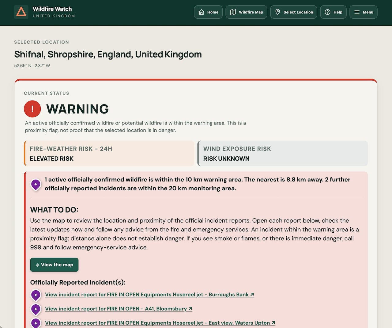
A single view brings together the current status, nearby evidence and the factors worth paying attention to:
Who it is for
Wildfire Watch is for anyone who wants earlier information about possible wildfire activity near a place that matters to them, including:
- Residents and communities checking conditions near their home or local area.
- Farmers, landowners and estate managers keeping an eye on land, livestock, crops, woodland and buildings.
- People responsible for businesses, venues or other sites who may need to review their plans when nearby conditions change.
- Outdoor workers, visitors and activity organisers checking an area before travelling or spending time outside.
- Community groups and local coordinators looking for a shared view of recently published information.
- People away from home checking on family, animals, property, land or a business from somewhere else.
- Second-home owners, holiday-home owners and landlords checking conditions near properties that may be unoccupied or managed from elsewhere, so they can review arrangements and contact local people when needed.
The service can help people stay aware and prepare. It does not replace instructions from fire and emergency services, local authorities or government agencies.
Choosing and monitoring a location
You can use your device’s location, search for a place or postcode, or choose a point on the map. The most recently selected location is remembered in this browser, so the same place can be shown when you return.
The wider monitoring area is checked for recent official incident reports and satellite-detected heat sources. The smaller warning area is used when deciding whether nearby evidence changes the current status.
You can adjust both distances above the map. A larger monitoring area checks farther away. The warning area cannot be larger than the monitoring area. A potential-wildfire group intersects the warning area when any of its member heat sources is inside it.
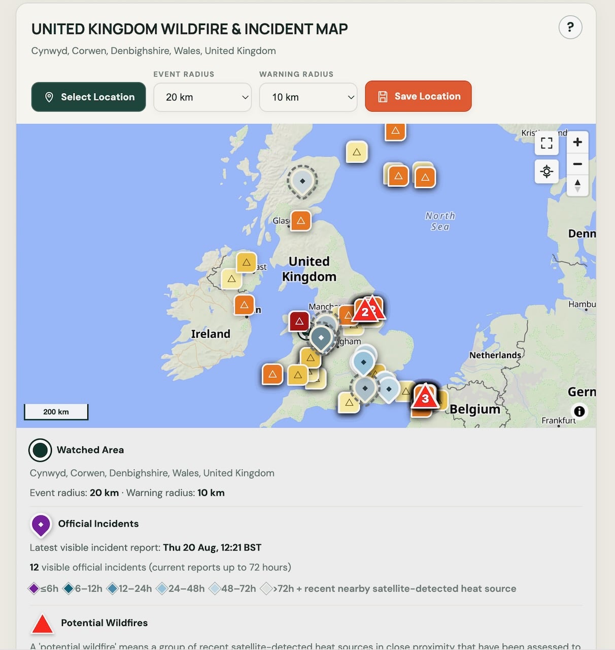
National Wildfire Map: The national map provides an overview of official incidents, satellite detections and potential wildfires across the United Kingdom, with controls for selecting a location and assessment radii.
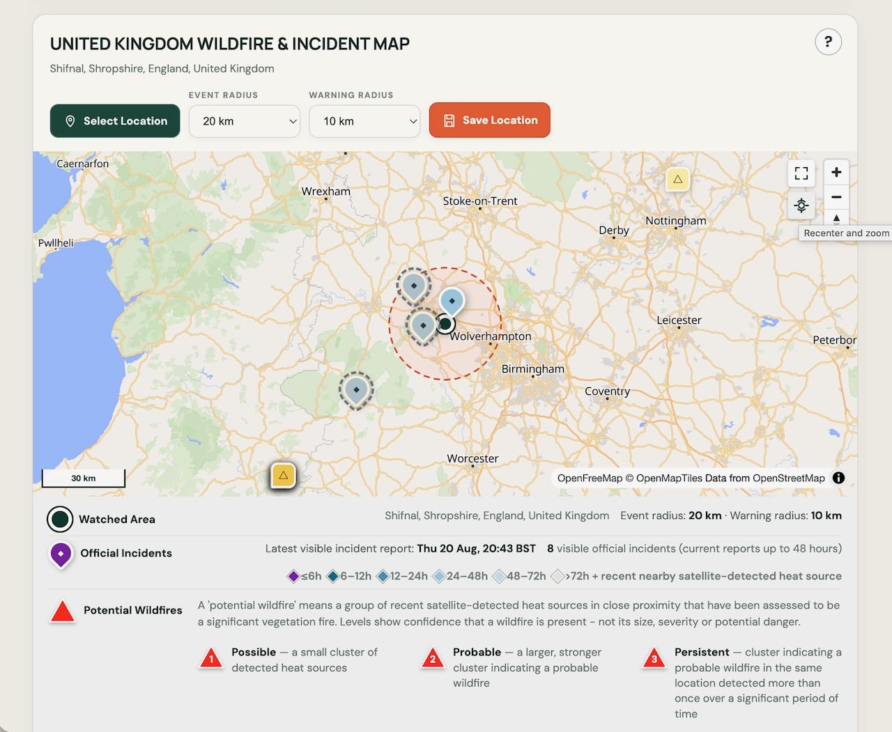
Local Wildfire Map: The local map shows incidents and potential wildfire activity around the selected location, together with its monitoring and warning areas and a key explaining the different markers.
Understanding the current status
- Clear means no relevant official incident or recent satellite heat source was found within the monitoring area.
- Watch means relevant evidence was found within the monitoring area but outside the warning area.
- Warning means an active officially confirmed wildfire or potential wildfire intersects the warning area. Warning is based on available evidence and proximity; it does not prove that the selected location is in danger.
Three different kinds of signal
- Current status describes nearby incident and satellite evidence.
- Fire-weather risk describes whether forecast conditions could help a fire start or worsen.
- Wind-exposure risk describes whether wind is blowing from nearby evidence towards the chosen location.
Each signal answers a different question. A low result for one does not cancel out a higher result for another.
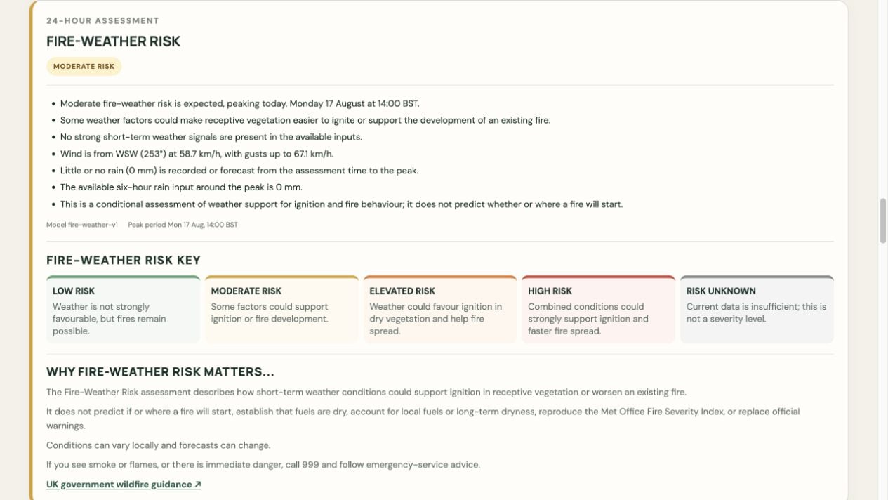
Fire-Weather Risk: The Fire-Weather Risk assessment explains how forecast wind, rain and other short-term weather conditions could support ignition or fire development during the next 24 hours.
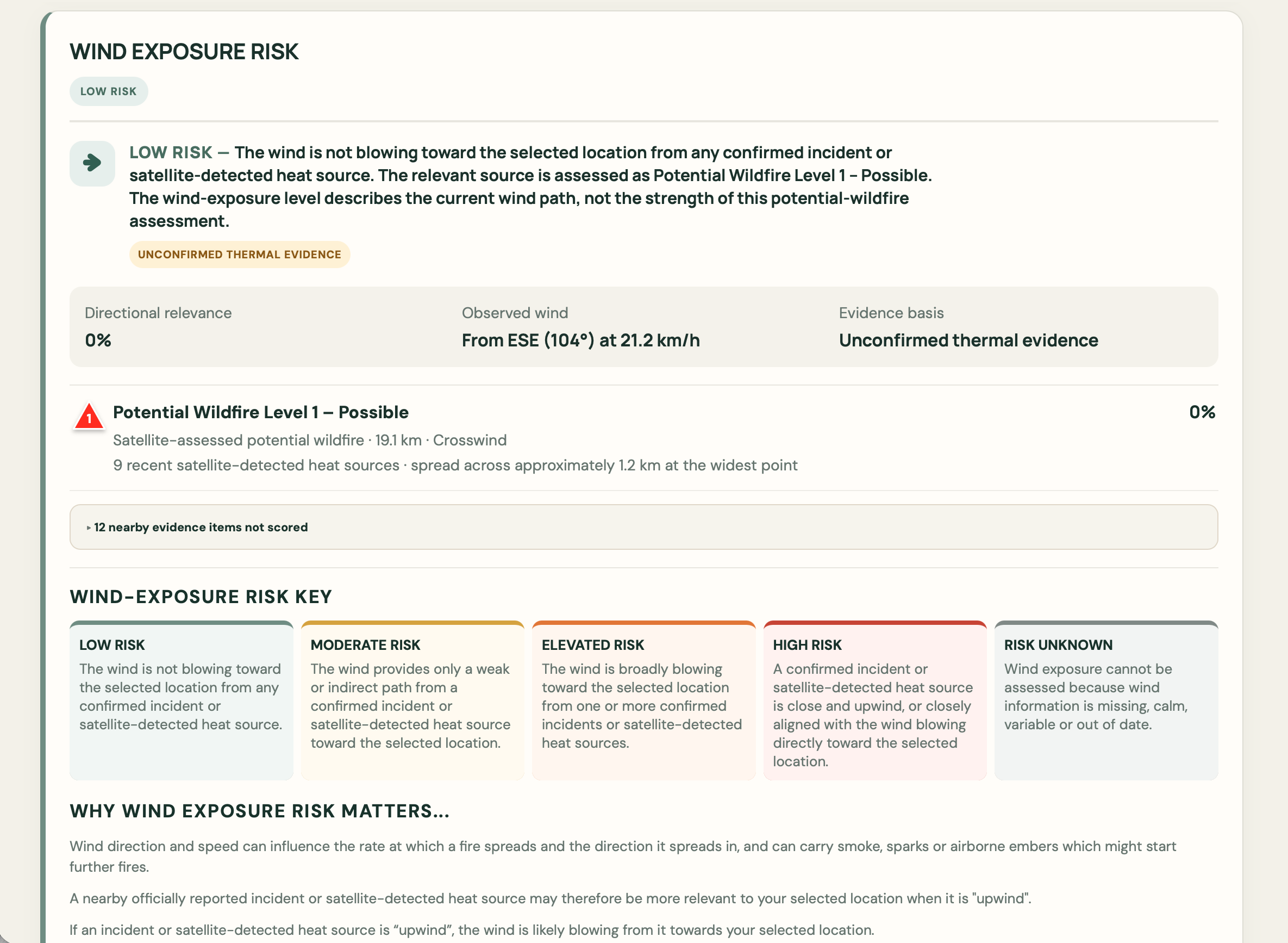
Wind-Exposure Risk: The Wind-Exposure Risk assessment shows whether winds are blowing from nearby wildfire evidence towards the selected location and explains the evidence used to calculate the result.
Reading official reports and satellite evidence
Official incidents come from approved public fire-service sources. Follow the link on an incident to read the latest information published by the attributable source.
NASA FIRMS is a satellite service that identifies unusual heat at the Earth’s surface. Wildfire Watch checks those detections within the monitoring area. A detection can indicate a possible wildfire, but it can also come from controlled burning, industry or another heat source.
Satellites do not watch every location continuously. They pass overhead at intervals, and NASA must receive and process each observation before FIRMS publishes it. Cloud, smoke, a missed satellite pass, processing delays or a temporary connection problem can all make an update late.
Why a delay matters: when an update is delayed, Wildfire Watch continues to use the latest available FIRMS detections and current official incident reports. The status can still be Clear, Watch or Warning, but a recent heat source may not yet appear in the satellite information.
The map keeps official reports, interpreted potential wildfires and individual satellite heat sources visually distinct. Timestamps and age keys help show how recent the evidence is.
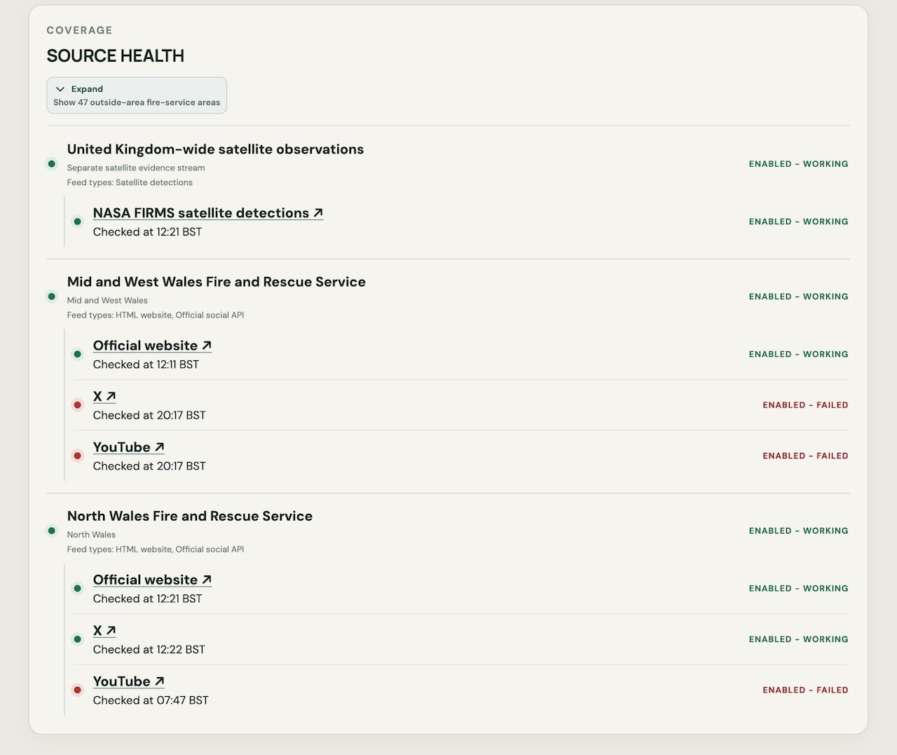
Source Health: The Source Health panel shows which satellite and fire-service information sources are currently working, delayed or failing, along with their latest check times.
Accounts and location monitoring
The public information service remains available without an account.
Get your FREE Personal Web account: create your account by 30 September 2026 and enjoy all the features of Personal Web for absolutely nothing until 31 March 2027.
What you get: save and automatically monitor up to three locations, receive Wildfire Watch and Warning alerts by email, and keep your alert history
No payment is taken. No card details are needed. Our gift to you
When the offer ends, your account returns to Free unless you choose to purchase Personal Web. Compare the features on the membership page.
Create your FREE Personal Web Account now
Important limitations
Official reporting varies between fire and rescue services. Satellite observations can be delayed, approximate, obscured or caused by heat sources other than wildfire. Weather indicators are estimates, not predictions of ignition or fire spread. Wildfire Watch does not fully account for distance, terrain, fuels or changing conditions.
An absence of official reports or satellite detections does not prove that no fire exists. Always consider the evidence alongside current official advice.
Who operates the service
Greener Systems Limited operates Wildfire Watch.
Read Why Wildfire Watch?, or learn about the operator and service boundary, methodology, source coverage and correction process.